5/22-24/17
Current location: Shenandoah NP, Big Meadows CG (yikes! we got behind)
We woke this morning with a decision to make: go for a run along a trail that didn’t have much in the way of views, or a slightly longer hike that would get us above treeline and with views of the surrounding area relatively quickly.

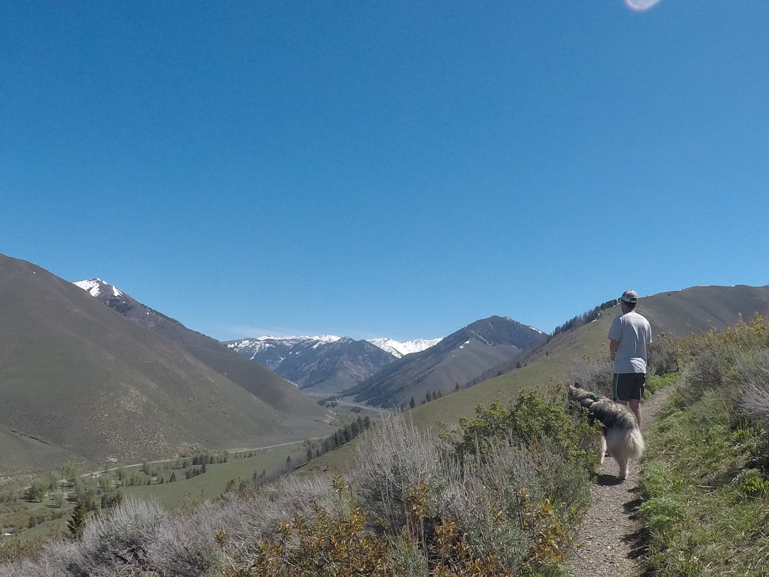
After a little debate, we started up the trail for Rudd Mountain and Proctor Mountain in Sun Valley. The trails were mostly dry and in and out of shade. Our route would bring us up one side, traverse across a ridgeline and then down the dividing ridge between the old ski area and the nordic center, where we’d meet the trail and complete our circle. By the time we got back, the three of us were quite warm and looked forward to standing in the chilly river next to the trailhead.


Rooney hopped right in, stretching his leash as far as we’d allow. Eric and I on the other hand tiptoed in, gasping a little as the water rushed against our shins. Eventually, we sat along a log in an eddy, ate a snack and then decided to dunk our heads and get the sweat off as best we could. Slightly cleaned up, we headed into town with a stop in Ketchum Cemetery to pay our respects at Hemingway’s grave. The grave stone was covered in a mix of pine needles, pennies, and an open beer.


Lunch was at an otherwise empty Sun Valley Brewery, I guess not too many people are going to the brewery for lunch in the beginning of the week. With full bellies, we pulled into our home for the evening, Meadows RV Park. On the to-do list: showers, laundry and some cleaning/drying of the van. We took full advantage of the sunshine and put the pieces of our bed out to dry after being in the damp weather of the Pac NW. Looking to further enjoy the sunshine, we headed back into town to the outdoor patio at Lefty’s Bar and Grill. Back to the campground after our samples of the local brews, we walked around the property as the light faded. We climbed into bed with the light of the day still on the horizon. We could get used to having daylight at 10pm!

Shower day...
Up early, and ready for the road, we headed to Craters of the Moon National Monument. As we got closer, the farmland and ranches faded to lava flows, and cinder cones. The monument was one of a series of hotspots that has a volcanic history that stretches from Yellowstone National Park to the south and west. From the top of one of the cinder cones, we could see nothing but lava flows for dozens of miles. Lava here flow from cracks in the surface, and is smooth in areas, while other areas are more explosive and jagged. The monument and NASA have worked closely together for some time, as the area allows astronauts to test equipment, such as rovers.


Side note: each location in the NPS system has junior ranger programs. Junior Rangers can be anyone who is interested in learning more about the park. To earn your Junior Ranger badge, one has to answer questions or complete a challenge from a pamphlet related to that specific park. The number of questions answered is equal to your age. While standing overlooking the sights from above, Eric stated “I feel like if I lived around here, I’d make my own spacesuit and hide in the bushes or walk around on some cinder cone far away. They’d say ‘Is that dude in a space suit?!’, and then they could check me off in the junior ranger book.”
We continued our drive northeast to Palisade Reservoir along the Idaho/Wyoming border. We’ve stayed in the area before and loved it. Today, we decided to camp in a slightly different spot, closer to the waterline. With the falling reservoir levels, more “beach” is opened. We chose to drive out nearly half a mile down the boat ramp to just a few yards from the edge of the water and set up shop. Rooney spent the afternoon wading in the water, checking out all the pieces of driftwood.


As the sun was setting, we thought the water level had risen a little bit, so Eric set up a few rocks to test that theory. Before heading in for bed, our suspicions were confirmed, water level was rising. We took bets where the water level would be in the morning, and marked our guesses with piles of rocks. We fell asleep listening to the sound of increasing wind and waves lapping on the shore. In the morning, we both chuckled as we climbed out of the van and saw that our guesses were completely incorrect and our rocks were submerged. Thankfully, there was still plenty of dry land between us and the water level (all of 5 yards or so).

We decided to take a slight detour and backtrack a bit to see Fall Creek Falls. Pulling up to the location of the falls, there was little sign of the views we were about to see. The creek was running high, and in sections, lapped along the edge of the dirt road. As we crossed over the creek to the edge, the water fell off to the Snake River below, cascading over a series of boulders. We watched the water falls for a while, then shifted our focus to the Snake River. Pelicans, hawks of many varieties and smaller song birds buzzed, soared and floated around us, each looking for breakfast. The water falls, river and wildlife was absolutely beautiful!


We spent the next few hours continuing along the river into Jackson, Wyoming. As we turned north, the river changed to a reddish brown, a clear sign there was significant landscape changes upriver.